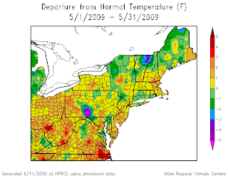


To look at the winter that will be arriving within short time on our doorsteps, I feel its pretty much important to look at what has been occurring over the last 5 months. Pretty much what has been the dominant pattern? What teleconnections have been essentially driving the weather. Basically since May 2009 we have been under a pattern that has been controlled by a Negative NAO (to neutral) a Negative EPO (to neutral) and a Positive PNA (to neutral)..This has been essentially the pattern that we have been being dominated by. This has caused a relatively up and down summer and perhaps one could say more down then up? May 2009 we ended up pretty much above normal temperature wise across the region. There will always be a small area of exception to this rule.
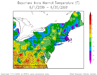
Then along came June and July 2009 ..that swung the pendulum in the opposite direction of below normal temperatures.
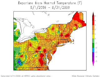
However...look what happened again come the month of August..
Another relaxation period had taken place. The temperatures swung the pendulum once again. So this brings us to current time frame..
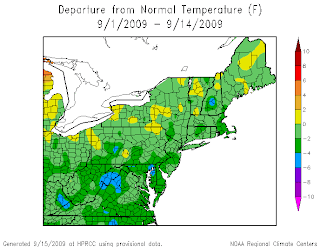
The pendulum once again has swung back into the pattern that has been established thru out pretty much of the summer. I pretty much have been aware of this pendulum and its swings and have referred to it as the TZT pattern. Expected this TZT pattern to return pretty much around mid september. Pretty much right on time, if not a tad earlier then expected.
This pretty much sets the stage for what should and could occur this winter. Proceeding on this pattern..my calculations would pretty much put September into the below normal category,as well as put October 2009 into the below normal category across the region. We have a relaxation period for the month of November..where temperatures will be above normal. Then back to December & January Below normal. Wash, rinse and repeat.
The EL Nino has not been able to gain any kind of a food hold. It really has been struggling from the get go of its existence. Indexes and teleconnections just do not want to cooperate enough to allow much further strengthening of the El Nino. The call from the beginning of this thread was for a Weak El Nino and i am beginning to think that that is where we will actually peak out at for ENSO State. I think the atmosphere is still feeling some lingering type effects of La Nina and this is also interfering with the El Ninos ability of gaining that foot hold.
If current pattern recognition is correct (both past as well as future) and October does end up below normal across the region..then this winter will be more of a winter for the cold & snow lovers across the region. One potential fly to the forecast is that temperatures could end up being so cold that the air could end up being drier then normal during those months. However, a positive to this pattern is that with the combination of -EPO +PNA -NAO (ridging on west, trough on east) then we would be looking at more storms taking the southern track and riding up the coast. So the potential exists this winter season for more coastal storms then previous winter seasons. If october ends up as thought, then we could be not only talking about cold (perhaps record cold) but we would also be looking at the potential for above average snowfall across the region and the potential for more significant indiviudal snow events.
So thats where i am at this point and time with where we been, where we are and where we are going. Of course I will update this as needed and whenever neccessary..

No comments:
Post a Comment