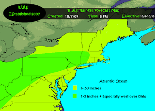
A warm front will be approaching the region thursday night. This warm front will move thru the area and be followed up on friday with a cold front. A S/W along the front will also move to the northeast across ohio and into the state of Pa. Precipitable water content looks to be in the 1-2 inch range..The heaviest of which rains will be further to the west. There is the possibility of thunderstorms with some slightly warmer air out ahead of the cold front. Although dewpoints will be relatively low ..the cooler air aloft and the warmer air at the surface might spark off some stronger storms.

No comments:
Post a Comment