

Just made some adjustments to the map that was made last night. The culprit responsible for the severe weather probabilities is essentially the same stationary front that is across the region..
http://www.hpc.ncep.noaa.gov/basicwx/91fwbgus.gif
Severe weather parameters
CAPE 500-2000 depending where you reside...
EHI is virtually non existent on the NAM
Helicity is also virtually non existent on the NAM
Lift index to about negative 7 depending where you reside..
Shear once again is 35 knots +
Temperatures in the 80s and 90s
Dew points in the 60s and 70s
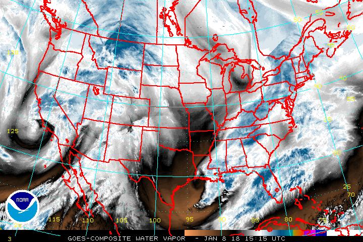
If you go to this link ( time sensitive) http://www.ssd.noaa.gov/goes/comp/ceus/wv-l.jpg
You will see how the moisture blew up over N C TX and the reason for the storms that occurred west of there..but you can also see when you put this into motion that drier air is also filtering back into the region..
http://www.ssd.noaa.gov/goes/comp/ceus/flash-wv.html
Dry air is noted by the brown color on the enhanced water vapor..
This front is really not going to move to much thru out the day, It may lift slightly north as a warm front but then essentially settle slightly south by evening..
So in TX there could be some isolated severe but the main thing we expect in that region is rainfall. Most of the region still has a dry RH 700 mb level ...and as Water vapor shows dry air is filtering in behind left over convection from yesterday.
With NO EHI essentially and no Helicity we are not really seeing a Tornado threat anywhere..Of course you always risk the threat of one with a severe storm but if any were to occur we expect them to be more isolated...
No comments:
Post a Comment