

May 3 Severe Weather Outlook
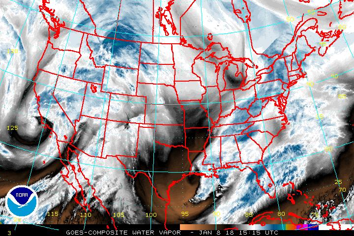
They often say a picture speaks 1000 words ..well in this case this picture speaks one word for the South central area....
http://www.ssd.noaa.gov/goes/comp/ceus/wv-l.jpg
That word is "Dry"...
Lets get right into it...It is going to be a warm day with temperatures in the 70s to 90s depending on where you are located...
http://www.twisterdata.com/data/models/nam/221/maps/2012/05/03/00/NAM_221_2012050300_F24_TMPF_2_M_ABOVE_GROUND.png
As mentioned above with the water vapor the dry air and you can see this in the 700 mb RH depiction as well...
http://www.twisterdata.com/data/models/nam/221/maps/2012/05/03/00/NAM_221_2012050300_F24_RH_700_MB.png
CAPE once again is 500-4500 depending on where you are located...
http://www.twisterdata.com/data/models/nam/221/maps/2012/05/03/00/NAM_221_2012050300_F24_CAPE_SURFACE.png
Lift index is as low as -12
http://www.twisterdata.com/data/models/nam/221/maps/2012/05/03/00/NAM_221_2012050300_F24_PLI_30_0_MB_ABOVE_GROUND.png
Shear as high as 70 knots over the North land west of the lakes
http://www.twisterdata.com/data/models/nam/221/maps/2012/05/03/00/NAM_221_2012050300_F24_SHRM_500_MB.png
Helicity is actually most impressive over the Great lakes themselves versus actual land region..
http://www.twisterdata.com/data/models/nam/221/maps/2012/05/03/00/NAM_221_2012050300_F24_HLCY_1000_M_ABOVE_GROUND_0_M_ABOVE_GROUND.png
EHI is above 1 in some isolated locations but the Helicity is not favorable in those locations so this just gives the indication that where those EHI values are could be the potential for some Tornadoes.
http://www.twisterdata.com/data/models/nam/221/maps/2012/05/03/00/NAM_221_2012050300_F24_EHI_1000_M.png
All and all it will be this cold front shown here as of 6 Z this morning...
http://www.hpc.ncep.noaa.gov/basicwx/91fwbgus.gif
That will be dropping towards the South and east that will bring the chance of severe weather once again to the areas depicted.
In eastern PA we think it will be more isolated as any storms will probably have a hard time making it over the mountains.
There will also once again be return moisture coming from the GOM and in this region you could see some severe as well..
Main threats are winds and hail... we put the tornado potential in the area reference with the EHI at 5% all other areas less then 2 %..
We will be tracking with statements and meso discussions from 12 noon thru 7 AM
No comments:
Post a Comment