
(Written and analyzed by RWS member Carlos [OmegaBlock]
As of Sunday July 18th @15:30Z/11:30AM, RWS official AIO (Area of Interest), which is located just to the E and NE of the Windward and Leeward islands, has been officially highlighted by the NHC since its 8PM EDT update last night, as it can be seen below:

Given the current favorable state of the MJO, which is in phase 2, plus a host of at least decent upper level parameters including upper level divergence, low level convergence, not perfect but decently bundled 850 vorticity energy, lack of SAL and, at least for the short term, decent to good water vapor (moisture) levels ahead of the official RWS and NHC AIO. However, there are two possible limiting factors and a third one, which would depend on the AIO's track. The short term limiting factors, would be current shear levels due to the ULL (Upper level low) located to the NE of Puerto Rico and possible drier air profile towards the central Bahamas due to lower levels of water vapor.
- The first limiting factor, the shear cause but the ULL to the NE of Puerto Rico. is always a bad factor to any tropical cyclone candidate. In this case, short term current shear profile forecast displays 20 to 30 knots of it, affecting the system as it gains latitude and track WNW towards Puerto Rico. However, the shear tendency forecast, implies it should dimish by as much as 10 knots, which would bring the shear down 10 to 20 knots, making the short tern shear profile much more bearable and somewhat better for organization of AIO #1.
- The second limiting factor would be the area of drier air around the central Bahamas area due to a lower level of water vapor (moisture profile) over there. This may be an eventual issue in case the moisture profile there does not become better to increase water vapor levels and AOI #1 tracks there as it may happen given the depiction shown by the current 250-850mb and 500-850mb steering currents.
250-850mb steering currents:


Below follow other important parameter images related to AOI#1 which were mentioned on the text above: (AOI #1 location and immediate surrounding parameter conditions)
Water Vapor IR: Current Shear:

Low Level Convergence:

Upper Level Divergence:

Current Shear:

Current Shear Tendency:


Upper Level Divergence:

Current Shear:

Current Shear Tendency:

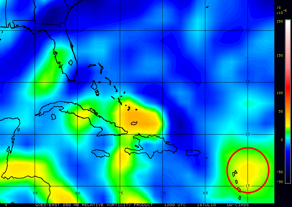
850mb Vorticity:
Assessment: An increase to 20% of AOI #1 chance of development into a tropical cyclone, may be in order for later updates still today by RWS, which would turn AOI #1 into Invest 97L. NHC may follow suite in its updates for today and into tomorrow, by increasing the chances for development to 20% as well and officially turn AOI #1 into Invest 97L, as well.
Notice: All images used are found on the CIMSS site, with the exception of the water vapor image which can be found on the NHC site on the satellite page.
No comments:
Post a Comment